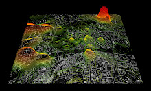
 Organização da Rede de Metropolitano de Londres por tempo: selecionando uma estação da rede, esta torna-se o centro do sistema de posicionamento orientando-se as restantes pelo tempo necessário à deslocação da primeira até estas últimas.
"This map by Amanda Cox and Matthew Ericson from The New York Times represents the travel times, in minutes, from Manhattan to stations in the region's commuter rail system during the evening rush. Each alternating ring shows how much farther you can travel in an additional 15 minutes, while the different color nodes are indicative of how fast, on average, the train travels to reach that station (in m.p.h.): red (15-25), orange (25-35), yellow (35-45), green (45+).
Travel times are based on trains departing Penn Station (New Jersey Transit, L.I.R.R.) or Grand Central Terminal (Metro-North) between 4 and 7 pm on weekdays. An average of the three fastest trains was used to capture the effect of express trains." in VisualComplexity


0 comentários:
Enviar um comentário